07/12/2008
USA - NASA maps potential ocean areas for “green” wind power
QuikSCAT (or Quick Scatterometer), which was launched on June 19, 1999, is a low-earth-orbiting, sun-synchronous satellite that the National Oceanic and Atmospheric Administration (NOAA) developed to measure wind speed, direction, and power over the world’s oceans.
The Earth-observing satellite is positioned at an altitude of 500 miles (800 kilometers) above the Earth’s surface and has a geocentric orbit, which means its altitude and inclination (98.6 degrees) has been coordinated so that it passes over the same point on the Earth’s surface at the same local solar time.
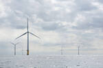
The NASA maps generated by QuikSCAT have the potential to be used to develop and build offshore wind farms in order to convert wind energy into electrical energy.
Funded by NASA's Earth Science Division, the research results are published as an article inthe journal Geophysical Research Letters.
The GRL article is entitled “Wind power distribution over the ocean.” Its authors are W. Timothy Liu, Wenqing Tang, and Xiaosu Xie, all from the Jet Propulsion Laboratory, California Institute of Technology, Pasadena, California, U.S.A.
The abstract to the paper states, “Probability distribution and power density of wind speed over global oceans are computed from eight years of QuikSCAT measurements. They describe the variation and higher moments of wind speed that are critical in relating the non-linear effects of wind on electric power generation capability, shipping hazard, and air-sea exchanges in heat, water, and greenhouse gases. The power density distribution confirms our general knowledge of atmospheric circulation related to mid-latitude storm tracks, trade winds, and monsoons. It also reveals regions of high wind power associated with flow distortion by land, wind channeled by land topography, and buoyancy effect on turbulent stress driven by ocean fronts.”
NASA senior research scientist Tim Liu, also the science team leader for QuikSCAT, stated, “Wind energy is environmentally friendly. After the initial energy investment to build and install wind turbines, you don't burn fossil fuels that emit carbon. Like solar power, wind energy is green energy."
Data about near-surface wind features from QuikSCAT has been generated by a specialized microwave radar instrument called SeaWinds. The instrument is also used to predict storms and enhance the accuracy of weather forecasts.
What does NASA think about the potential of such wind energy sources?
According to the NASA article (“Ocean wind power maps reveal possible wind energy sources“), “Wind energy has the potential to provide 10 to 15 percent of future world energy requirements, according to Paul Dimotakis, chief technologist at JPL. If ocean areas with high winds were tapped for wind energy, they could potentially generate 500 to 800 watts of energy per square meter, according to Liu's research. Dimotakis notes that while this is slightly less than solar energy (which generates about one kilowatt of energy per square meter), wind power can be converted to electricity more efficiently than solar energy and at a lower cost per watt of electricity produced.”
The article continues to state, “According to Liu, new technology has made floating wind farms in the open ocean possible. A number of wind farms are already in operation worldwide. Ocean wind farms have less environmental impact than onshore wind farms, whose noise tends to disturb sensitive wildlife in their immediate area. Also, winds are generally stronger over the ocean than on land because there is less friction over water to slow the winds down - there are no hills or mountains to block the wind's path.”
And, “Ideally, offshore wind farms should be located in areas where winds blow continuously at high speeds. The new research identifies such areas and offers explanations for the physical mechanisms that produce the high winds.”
The research so far has concluded that one area of high-wind potential is found off the coast of Northern California—near Cape Mendocino. The area contains a protruding land mass that deflects northerly winds, producing a local wind jet that blows all year long.
Other areas of potentially high-wind producing areas, identified by the QuikSCAT data, include westerly winds blowing around Tasmania, New Zealand, and Tierra del Fuego in South America.
Generally, areas with high wind power potential are found in the mid-latitude regions of the Atlantic Ocean and the Pacific Ocean.
For additional information on QuikSCAT, please go to the Jet Propulsion Lab website “SeaWinds on QuikSCAT.”
- Source:
- QuikSCAT
- Author:
- Posted by Trevor Sievert, Online Editorial Journalist
- Email:
- ts@windfair.net
- Link:
- www.windfair.net/...
- Keywords:
- wind energy, wind farm, renewable energy, wind power, wind turbine, rotorblade, offshore, onshore


