News Release from windfair.net
Wind Industry Profile of
New Insights with LiDAR Measuring Techniques
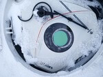
 Laser-based telemeters offer a cost-effective alternative to the usual wind measuring masts (Photo: Fraunhofer IEE)
Laser-based telemeters (LiDAR = Light Detecting And Ranging) are being used more frequently in wind industry. They offer an inexpensive alternative to wind measuring masts, because the devices are able to measure wind speeds and directions at great heights from the ground. Similar to the radar, the LiDAR device emits laser beams being reflected by particles that move with the wind. This allows predictions about wind potential and expected energy yield of the site. Once a wind farm is operating, measurement results can be sent to control rooms to ensure optimum adjustment of the turbines.
The Fraunhofer Institute for Energy Economics and Energy System Technology (IEE) points out the advantages over conventional measuring masts: "LiDAR systems do not require a building permit, require less space and can be set up at different locations with little effort.“
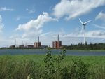
However, the possibilities of LiDAR measurements go far beyond. In England, for example, a current research project is using LiDAR measurements to determine flight altitudes of birds. This should be of particular benefit to the offshore industry, as the North Sea, for example, with its high density of offshore wind farms, is also one of the main routes for bird migration.
Last November, APEM, an independent environmental consulting company specialising in freshwater and marine ecology and aerial survey, equipped a special survey aircraft with an ultra-high resolution Leica RCD-30 camera combined with a LiDAR system. During the survey, the aircraft flew at a height of 340 m and collected images and LiDAR data from a 346 m wide area. During the flight, the system recorded information on characteristics of the landscape and birds in flight, both in swarms and individual flying birds.
After data processing, the researchers were able to determine the flight altitudes of the birds to within 5 cm. Such precision has not been possible so far, as previous knowledge of flight altitudes has been based on visual estimates from observers in boats, measurements with laser rangefinders of people stationed on offshore wind turbines or data from GPS transmitters attached to birds, APEM emphasises.
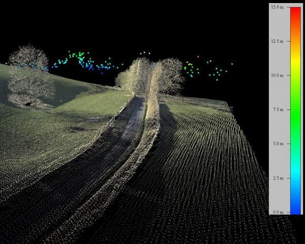
Surveying was carried out on land, but a similar experimental set-up can also be used above sea level (Photo: APEM)
Dr. Mark Rehfisch, Head of the Department of Ornithology at APEM, says: “A LiDAR-based approach is the future of flight height assessment in open terrain. It is very precise and accurate, it generates a permanent record, it can be applied rapidly over large areas of open habitat, and it will become increasingly affordable as the technology is taken up.”
Research project 'Optimization of LiDAR-based measurement strategies for the site evaluation of wind farms' (LiMeS) has also set itself the goal of further refining the possibilities of LiDAR technology. Fraunhofer IEE has joined forces with various wind industry companies, Philipps University of Marburg and the University of Kassel. The German Federal Ministry of Economics and Technology also supports the project financially.
Aim of the project is to identify causes of measurement uncertainties and to quantify their influence with a focus on measuring duration, location and number of measuring points as well as the measuring technology used. In a second step, a procedure is to be developed that estimates the overall uncertainty and the costs of various measurement strategies for project-specific boundary conditions, e.g. area size and location, terrain structure and locations of planned wind turbines, as stated in the description for the research.
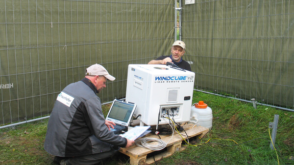
Construction of a LiDAR device to determine the wind potential at a forest location (Photo: Fraunhofer IEE)
To this end, the project relys on the help of other experts who are to take part in a comparative round robin test to investigate the long-term correction of very short-term wind measurements at hub height (three to six months).
Alexander Basse from the University of Kassel is available for further information on the procedure and the possibility of participating in the Round Robin Test starting in April.
- Author:
- Katrin Radtke
- Email:
- press@windfair.net
- Keywords:
- LiDAR, laser, Fraunhofer IEE, APEM, measuremtn, wind, altitude, bird, migration, developer