News Release from DNV
Wind Industry Profile of
03/09/2011
EWEA 2011 - The Viability of Potential Wind Power Projects
 GL Garrad Hassan at the EWEA 2011
In his presentation at EWEA 2011 in Brussels, Daniel Jaynes, GL Garrad Hassan, takes a closer look on the efficacy of floating LIDAR motion compensation algorithms for offshore wind resource assessment applications. The presentation will be held on Monday, 14.03.2010, 16:00 - 17:00 at EWEA 2011.
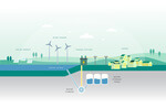
Because many offshore wind farm projects are in stages of early design, inexpensive wind measurement alternatives to costly meteorological masts have received attention from the growing offshore wind energy project planning community. In recent years, LIDAR remote sensing technology has emerged as an alternative due to the advent of systems that allow deployment in offshore environments by mounting them on floating buoys, equipped with motion compensation algorithms to account for the dynamic nature of the buoy.
This investigation aims to explore the accuracy and value of floating LIDAR systems by studying the efficacy of the motion compensation algorithms that are applied to correct wind data recorded by such devices. An experimental study is presented that demonstrates the comparison of high quality, calibrated wind speed measurements from a well-equipped meteorological mast and measurements supplied by a nearby floating LIDAR unit.
The measurement campaign consists of two phases. First, the LIDAR system is deployed in a stationary, on-shore configuration near an operational met tower to establish a frame of reference. Second, the floating buoy system is deployed in a nearby offshore environment where the role of motion compensation algorithms can be assessed relative to measurements collected at the same nearby meteorological mast. The results of this analysis help demonstrate the potential that floating LIDAR systems have for offshore wind resource assessment applications.
www.gl-garradhassan.com/
- Source:
- GL Garrad Hassan
- Author:
- Posted by Trevor Sievert, Online Editorial Journalist
- Email:
- info@garradhassan.de
- Link:
- www.gl-garradhassan.com/...
- Keywords:
- Garrad Hassan & Partners Limited, wind energy, wind power, wind turbine, onshore, offshore, windmill, www.windfair.net, Trevor Sievert, ECA